SprayLogger by AgTerra
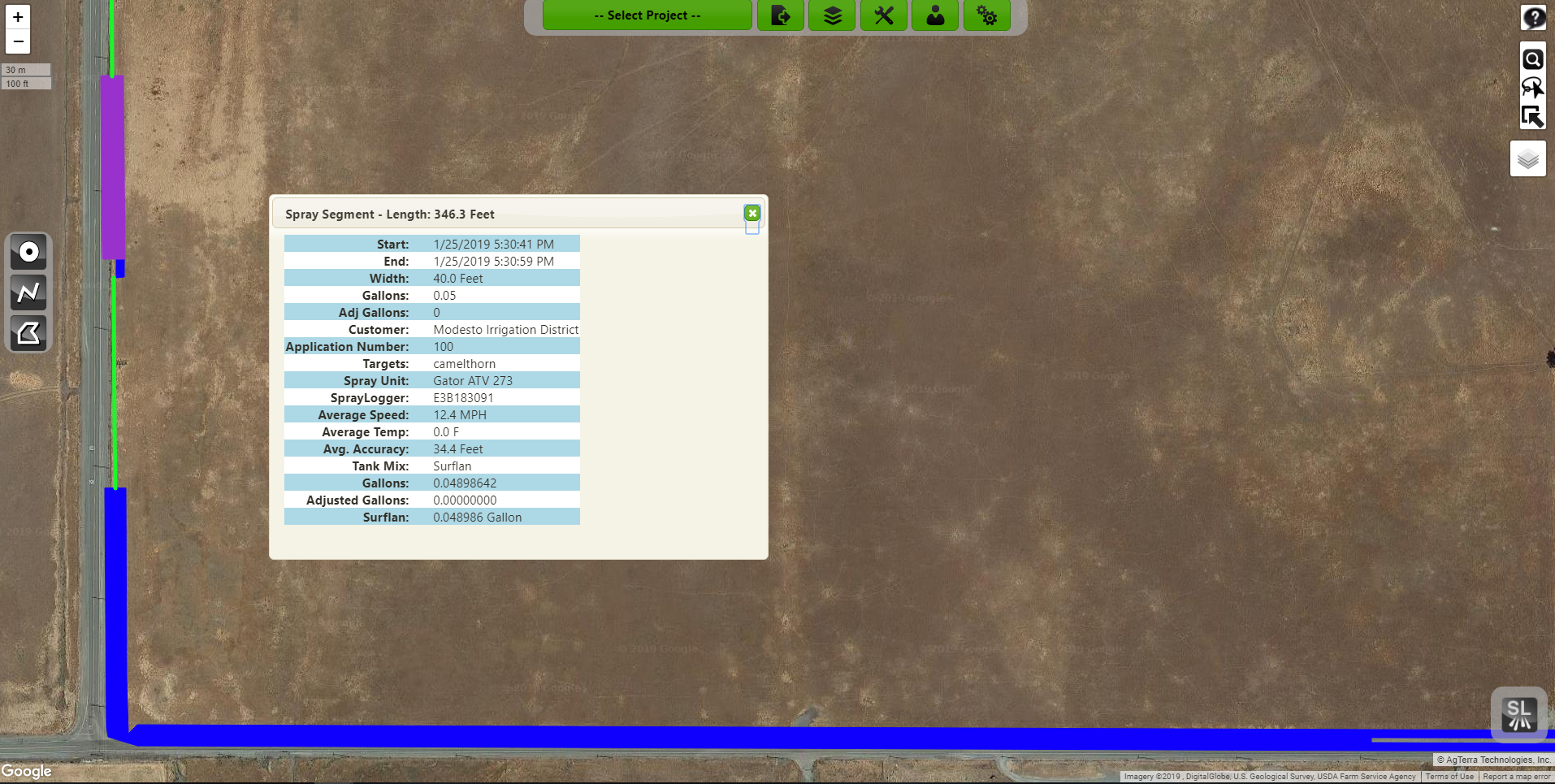
We are proud to present SprayLogger and Map It Fast, a solution to overcomplicated, and burdensome mapping products. SprayLogger is an easy to use pesticide and herbicide management system that offers unprecedented record-keeping in many different fields of application. SprayLogger is capable of paint on-screen mapping, allowing for the immediate recognition of applied material by the operator. Every detail about the job is monitored and saved for record-keeping purposes including acres sprayed, miles sprayed, chemical type, chemical applied, the width of the spray pattern, and so much more!
SprayLogger is capable of working anywhere. There is no need for a data connection because SprayLogger stores its data locally on an Android mobile device. Although, if using a device with a data connection then SprayLogger is able to show the location of the applicator in real-time; as well an operator is able to upload Strider forms and spray jobs as soon as they are completed, to the cloud. Once in the cloud, your data is kept secure and reachable, anywhere with a data connection!

SprayLogger is simple and easy to use, requiring the operator only 5 questions to start a spray job. With those 5 questions a wide array of information is logged and recorded; and a dizzying array of reports and forms can be made to easily report weather conditions, spray conditions, spray and no spray lines, and amount of chemicals applied. SprayLogger can also export into excel for finding information such as total gallons of a chemical used in a year. Lastly, SprayLogger is cable of exporting to any GIS using shapefile, KMZ, GPX, or use the optional API to integrate with ESRI geodatabases.
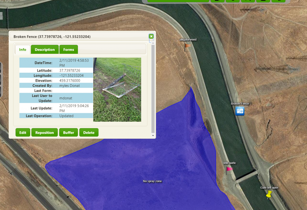
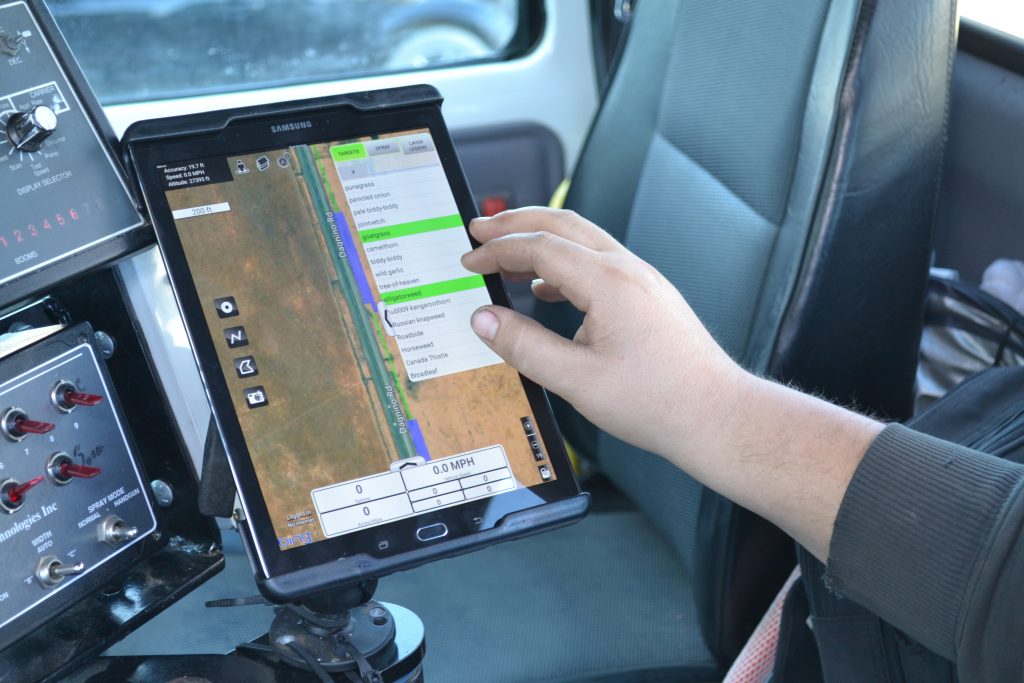
While SprayLogger is able to be started in only 5 questions, don’t mistake that for a lack of functionality. For example while in a job the operator can select currently targeted weeds in real-time, allowing for the capture of the specific weeds being sprayed. The operator has also the option to insert points, lines, polygons and photos for marking and reporting changing land conditions. As an example, the point tool could be used to mark potholes, trees, telephone poles, and anything else that needs to be marked with a point. Continuing, the line tool and polygon tool are able to map out stretches of land, quickly and accurately, with a speedy response in land size or length.